4.2.14 | By: Deb

Antigua and Hiking the Pacaya Volcano


Pacaya Volcano

After a 3.5 hour shuttle from San Pedro La Laguna I arrived in Antigua around noon.

My plans here include one day to see the city and one day to hike nearby Pacaya Volcano.

Built in an earthquake-prone region, Antigua was founded in 1524 and it was subsequently destroyed by fire caused by an uprising of the indigenous population. It was re-established in 1527 and entirely buried as a result of earthquakes and an avalanche in 1541. Built again, it survived natural disasters of floods, volcanic eruptions and other serious tremors until 1773 when the Santa Maria earthquakes destroyed much of the town.

At this point, authorities ordered the relocation of the capital to a safer location region, which became Guatemala City, the county’s current capital. Some residents stayed behind in the original town, however, which became referred to as “La Antigua Guatemala”.

Central park.

Dirty fountains!!! haha

Views of one Antigua's 3 surrounding volcanoes in the distance.


View from the roof of my hostel

Most of the surviving buildings date from the 17th and 18th centuries and are considered magnificent examples of colonial architecture in the Americas. Distinctive characteristics of this architectural style include the use of decorative stucco for interior and exterior ornamentation, main facades with a central window niche and often a deeply-carved tympanum, massive buildings, and low bell towers designed to withstand the region’s frequent earthquakes.


The city lay mostly abandoned for almost a century until the mid-1800s when increased agricultural production, particularly coffee and grain, brought new investment to the region. The urban core is small, measuring approximately 775 meters from north to south and 635 meters east to west. You can easily walk anywhere you need to go here.

Its a nice little town...walkable but with lots of great restaurants. I stumbled on a Mcdonalds, 1st one I've seen anywhere in Guatemala so far, and it is the most beautiful Mcdonald's I've ever seen! The restaurant opens up into a beautiful courtyard with gardens and fountains. I always indulge in their apple pies whenever I leave North America...It's one of my favorite things but sadly in the early 90's all of North America switched them to baked apple pies.... which are not good....BUT, everywhere else in the world they still have the old school deep fried ones! Yummy!


Yeah!!! Deep fried trans fat goodness!!!!

Once I arrived and checked into my hostel, I signed up for an afternoon trip to hike the Pacaya Volcano...I was originally going to do it the next day but figured that since half of the day was already lost to traveling I might as well do it now and then on day 2 here I can sleep in and wander around town at my leisure. I had an hour to grab lunch, pack my bag and be ready for the shuttle pick up at 2pm.


The Pacaya volcano, about 1.5 hrs form Antigua, is one of Guatemala's most active volcanoes, and its frequent eruptions are often visible from Guatemala City.


Pacaya rises to an elevation of 2,552 meters. After being dormant for a century, it erupted violently in 1965 and has been erupting continuously since then.
Much of its activity is Strombolian ( short-lived, explosive outbursts of pasty lava ejected tens or hundreds of meters into the air ) but occasional Plinian (powerful convecting plumes of ash ascending up to 45 kilometers into the stratosphere) eruptions also occur, sometimes showering nearby areas with ash.


Cool skies!


Several years ago you used to be able to see lava on this hike but, sadly, none currently. However, it did erupt Jan 13-20 of this year and lava was ejected 70 meters high with flows reaching 2.8-3 km long. Bluish-white gas plumes rose 300 meters.

I JUST missed it by a few weeks. There are lots of hot steam vents near the top that are hot enough to roast marshmallows on though and the hike was super scenic.


Day 2 in Antigua, I had the best shower ever..... I washed half of  the volcano off of me (water was cold that night so had to hold on till the am...I'm a fare weather bather), and I found a little laundry place near the hostel where I finally washed some clothes. It's been cool here in the evening and my long sleeve shirt/hoodie and pants are the uniform of choice every night....not to mention my socks, post volcano, really needed a wash. It was a real treat to wear fresh smelling clothes again!

I am currently in Honduras. I took a 6 hour bus here...starting at 4am (ugh) and after bribing the Guatemalan border guards to let me leave the country and the Honduras border guards to let me into their country (super corrupt here!) I arrived around 11ish in the charming town of Copan Ruinas.

Tonight my plans include dinner and early to bed. I spent all afternoon today in the Mayan Copan Ruins and tomorrow am heading to a Macaw sanctuary. It's a bird watchers dream here!

3.2.14 | By: Deb

Exploring Lake Atitlan


Boat trip between Lake towns.

I spent my last couple days on the Lake town hopping and exploring.

The placement of the towns around lake Atitlan and their names reflects the deeply mystical nature of the Indians; It is all set up as a visual representation of the world as the Maya knew it.  The different towns were positioned on the special cardinal points, starting with Santiago and proceeding around the lake.  The circle also follows the old calendar; 18 months of 20 days each and the 5 special "dead days" that fall miraculously on Easter week.


Panajachel's dock


Santiago from the boat.
The towns are named because of where their positions are according to the Saints day that corresponds with the date that fits with where the town is (Santiago Atitlan, the largest town on the lake, owes its importance to its position as the center of the Tzutujil nation, and because of the pass to the coast.)

Santiago

Santiago

Santiago
As far as any volcanic activity from the volcano's surrounding the lake they appear to be sleeping. There is no record of San Pedro having erupted in pre Hispanic or recent times, and Toliman has not erupted within historic times. Atitlan has erupted several times since 1469 but it's been more than 100 years since the volcano last erupted... although there are steam vents at the top and Atitlan still claims an occasional victim when people inadvertently find a gas cloud. 

In Panajachel, the biggest town, I went to the nature reserve and wandered around town a bit. I actually debated staying here before deciding on San Pedro as my base....after visiting it I definitely made the right decision. It was crowded and big with lots of traffic. San Pedro is so much nicer with a better vibe.
 
Panajachel


View from Panajachel

Panajachel's lake side path
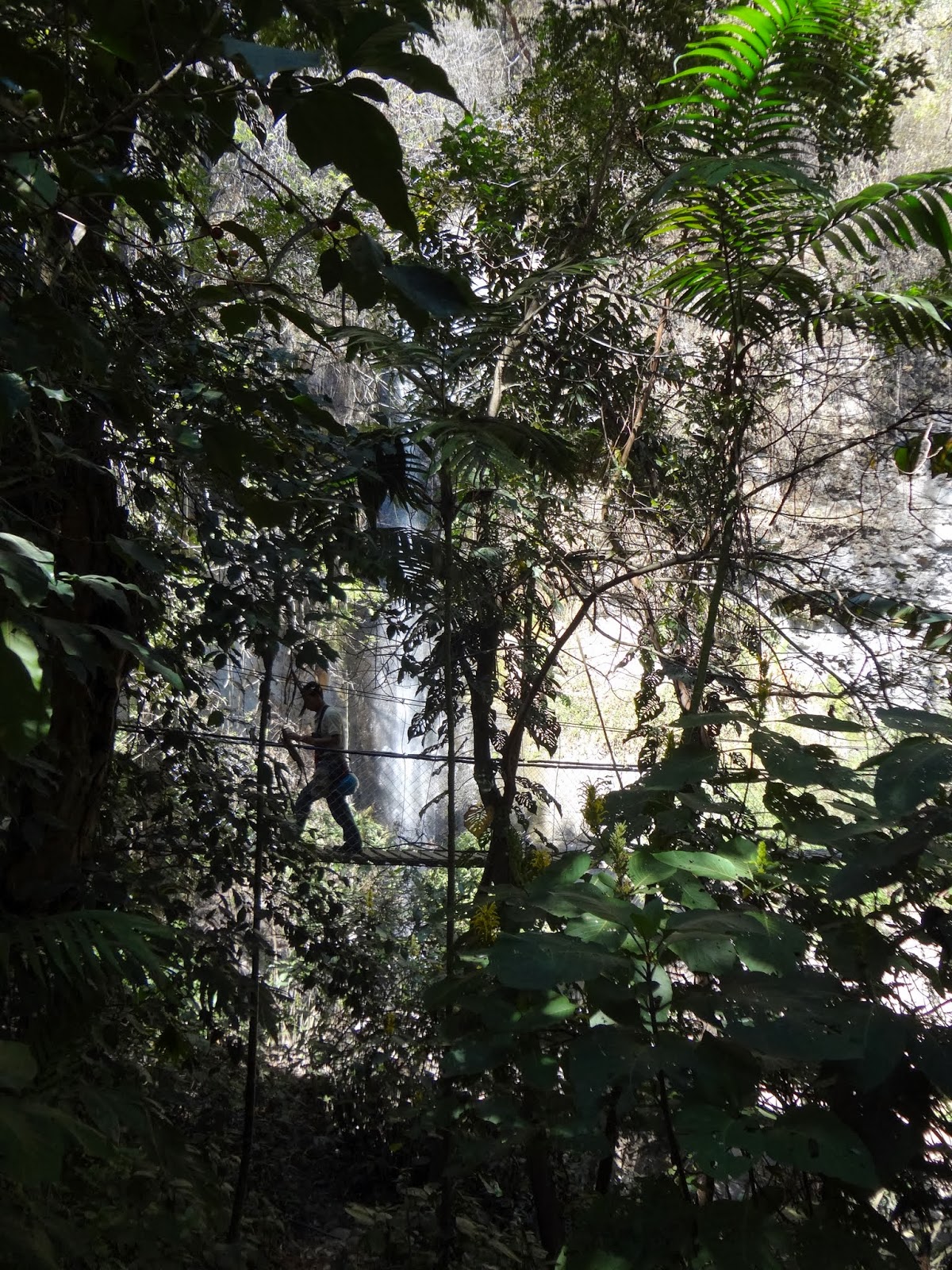
The Atitlan Nature Reserve has tons of self guided hikes complete with suspension bridges over the waterfall.

There is a butterfly sanctuary and a super fun tour of eight zip lines ranging from 90 meters to 320 meters along waterfalls, canyons, the valley and the coffee grove forest.

Hiking in the nature reserve.


Butterfly sanctuary in Panajachel


The zip lines were definitely a highlight and I was high on adrenalin! I first climbed the mountain then crisscrossed my way down across a deep valley. The top speed is 30feet/second!


Fear factoresque walk over a river.
 

1.2.14 | By: Deb

Lake Atitlan


Lake Atitlan, surrounded by three dormant volcanoes and steep cliffs, is a result of volcanic activity that occurred nearly 85,000 years ago....It formed in the crater of a giant volcano. It is the deepest lake in central america, 10 miles at its widest and considered one of the most beautiful lakes in the world.


It’s so deep, over a mile down, that many scuba divers wonder if some rare marine creature will emerge one day. It's about a mile above sea level and the location prevents the water from flowing back into any sea. Much of the lake’s shoreline is accessible only by boat. The hills above the lake are equally inaccessible except by foot paths and the occasional bumpy road.


In the Mayan language, Atitlán translates to “the place where the rainbow gets its colors”. To this day the Atitlán area of Guatemala is rich in Mayan culture with friendly locals that still dress in traditional costumes.

Lake Atitlán is located in the coffee growing region of Guatemala with its water supporting many coffee farms in the area. When driving here you could watch the locals harvesting the coffee bean in the hills along the side of the road and drying them.


This town is full of cute narrow paths, too small for cars. Mostly only horses, motorcycles and tuk tuks around here.

The pier. You catch boats to visit all the islands.


An element found in Lake Atitlan is a wind called “Xocomil”, which is generated at noon, when the warm winds from the south colliding with cooler air masses coming from the highlands … this results in eddies that stir the waters of the lake to become very strong waves.


The Pier at San Pedro
Boat ride into San Pedro from a day trip I took to Panajchel

I am staying in one of the little towns called San Pedro La Laguna....it's big enough to have good restaurants, an ATM etc. but small enough to walk everywhere.

I really like the vibe here. It's small, walkable, safe and has some really great restaurants. Everything is really cheap in Guatemala as well...I can eat a full meal for about $4-8, it cost about $1-3 to take a boat to any of the other towns and if you want the tuk tuks will take you anywhere in each town for a dollar.

My hotel has incredible landscaping. I LOVE their gardens.


My beautiful hotel, this is the view right outside my window.
The only weird thing about this town is that it attracts this strange hippy tourist...At least 80% of the foreigners here have obviously been here for a while...stopped bathing regularly, stopped cutting their hair (most have dreadlocks) and wear this weird assemble of non-coordinating clothes and most of the men are in skirts. You can guess how long someone's been here by the length of their hair. It's every age range too...super odd, I've never seen anything like it. I feel like there are no travelers here I have anything in common with. I've been trying to sneak some pictures of  people to show you but it's hard to do that stealth! Here's one I snapped last night...not great but gives you an idea.

The "old man" version of the San Pedro hippy
Today is my last day here. I plan of hopping on a boat to visit a couple more of the towns. Tomorrow morning at 7:30 I leave for Antigua.